#
REST API
The REST API is used to interact with the Immersal Cloud Service.
You can use it to submit images for Spatial Map construction, modify and load Maps, and even use the on-server Visual Positioning.
- Most REST API requests take JSON as input and also return the result as JSON
- Most requests need a valid developer token for authentication. You can get it by logging in to the Developer Portal
We provide a sample implementation for Unity in C#, see the REST.cs and RESTJobsAsync.cs classes in the Immersal SDK Core .unitypackage
We also provide basic Python examples in this documentation.
It should also be quite straightforward to make the API calls in JSON from e.g. JavaScript & WebXR applications, and on other platforms.
Immersal Cloud Service REST API requires a developer token for authentication. You can get it from the Developer Portal
#
API Methods
#
Aligns maps
https://api.immersal.com/align Aligns maps into the same coordinate space. First map in mapIds array is used as the origin for the other maps. Only private maps can be aligned. Only maps with status "done" can be aligned.
#
Parameters
#
Responses
{
    "error": "none",
    "id" : 67123, //alignment job id
    "size" : 3 //how many maps was used
}
{
    "error": "auth" //invalid developer token
}

{
    "error": "query" //error connecting to database or no results
}

{
    "error": "map count" //map array was empty or has some invalid maps or more than max amount (32) maps
}

{
    "error": "name" // invalid map name
}

{
    "error": "could not create user dir" //error creating a directory for user
}

{
    "error": "could not create dir" //error creating a directory for the constrction job
}

{
    "error": "could not open desc file" //could not open a file describing the job parameters
}

{
    "error": "could not open file" //error opening the file to write the align results
}
#
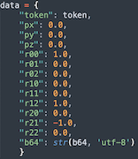
B2G Upload (base64)
https://api.immersal.com/b2gb64Submit a .b2g file in b64 encoded format from a Leica BLK2GO device and metadata to the user's workspace.
Pro or Enterprise license is required to use this feature.
Note that this end point only uploads the b2g file. One should call /construct endpoint after uploading. Also preservePose=true parameter should be used in the /construct call to leverage BLK2GO pose data.
To match BLK2GO coordinate system with Immersal coordinates the rotation matrix should be set as follows:
#
Parameters
#
Responses
{
    "error": "none",
    "path": "path_on_the_server"
}
{
    "error": "auth" //invalid developer token
}

{
    "error": "query" //error connecting to database or no results
}

{
    "error": "image limit" //user image limit per map exceeded
}

{
    "error": "image format" //error parsing image format
}

{
    "error": "level" //user has not been authorized for enterprice license
}

{
    "error": "hash" //uploaded file may be corrupted
}

{
    "error": "rename" //renaming path filename failed
}
#
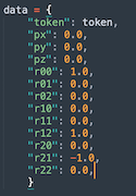
B2G Upload (binary)
https://api.immersal.com/b2gSimilar to /b2gb64 but faster. The b2g data is not b64-encoded but the payload is binary: json bytes + NUL terminator byte + b2g bytes.
Supports robust chunked uploads via /upload endpoint.
Pro or Enterprise license is required to use this feature.
Note that this end point only uploads the b2g file. One should call /construct endpoint after uploading. Also preservePose=true parameter should be used in the /construct call to leverage BLK2GO pose data.
To match BLK2GO coordinate system with Immersal coordinates the rotation matrix should be set as follows:
#
Parameters
#
Responses
{
    "error": "none",
    "path": "path_on_the_server"
}
{
    "error": "blob" //invalid binary payload
}

{
    "error": "auth" //invalid developer token
}

{
    "error": "query" //error connecting to database or no results
}

{
    "error": "image limit" //user image limit per map exceeded
}

{
    "error": "image format" //error parsing image format
}

{
    "error": "level" //user has not been authorized for enterprice license
}

{
    "error": "hash" //uploaded file may be corrupted
}

{
    "error": "rename" //renaming path filename failed
}
#
Capture Image
https://api.immersal.com/captureb64Submit the image and metadata to the user's workspace. The camera pose should be submitted in a right-handed coordinate system and the rotation is submitted as a row matrix.
https://developer.apple.com/documentation/arkit/arconfiguration/worldalignment/gravity
https://developer.apple.com/documentation/arkit/arcamera/2875730-intrinsics
If fx,fy,ox and oy parameters are omitted, the image assumed to be a 360 equirectangular image.
#
Parameters
#
Responses
{
    "error": "none",
    "path": "path_on_the_server"
}
{
    "error": "auth" //invalid developer token
}

{
    "error": "query" //error connecting to database or no results
}

{
    "error": "image limit" //user image limit per map exceeded
}

{
    "error": "image format" //error parsing image format
}
#
Capture Image (Binary)
https://api.immersal.com/captureSubmit the image and metadata to the user's workspace.
Similar to /captureb64 but faster. The image data is not b64-encoded but the payload is binary: json bytes + NUL terminator byte + image bytes.
Supports robust chunked uploads via /upload endpoint.
The camera pose should be submitted in a right-handed coordinate system and the rotation is submitted as a row matrix.
https://developer.apple.com/documentation/arkit/arconfiguration/worldalignment/gravity
https://developer.apple.com/documentation/arkit/arcamera/2875730-intrinsics
If fx,fy,ox and oy parameters are omitted, the image assumed to be a 360 equirectangular image. Python example:
body = json_bytes + b"\0" + img_bytes
r = requests.post(complete_url, data=body)
#
Parameters
#
Responses
{
    "error": "none",
    "path": "path_on_the_server"
}
{
    "error": "blob" //invalid binary payload
}

{
    "error": "auth" //invalid developer token
}

{
    "error": "query" //error connecting to database or no results
}

{
    "error": "image limit" //user image limit per map exceeded
}

{
    "error": "image format" //error parsing image format
}
#
Clear Workspace
https://api.immersal.com/clearDeletes all the images from the workspace. Setting the anchor parameter to false will retain the anchor image.
#
Parameters
#
Responses
{
    "error": "none"
}
{
    "error": "auth" //invalid developer token
}

{
    "error": "query" //error connecting to database
}
#
Clear Map Access Token
https://api.immersal.com/clearmaptokenClears a map access token. Map access token is a way to allow sharing of a private map. Only owner of a map can clear map access token.
Map access token holder can access for example map metadata, download poses and download the map. This is a good way to build an app and share your maps to a smaller group without making it public for everyone.
Map access token can be set, renewed or cleared. By default, a map does not have an access token. A new access token is unique and previous access tokens cannot be retrieved.
Endpoints that support map access token are:
- /dense
- /geopose
- /getposes
- /loadmap (may be deprecated)
- /localizeb64
- /localize
- /map (NOTE /mapb64 is not supported!)
- /metadataget
- /sparse
- /tex
#
Parameters
#
Responses
{
    "error": "none",
    "mapId": 12345, //id of the map affected
    "accessToken": "cleared"
}
{
    "error": "auth" //invalid developer token
}

{
    "error": "query" //error connecting to database
}
#
Map Construct
https://api.immersal.com/constructStarts a new map construction job.
#
Parameters
#
Responses
Returns the ID of the constructed map and number of images in it
{
    "error": "none",
    "id": 7065,
    "size: 300
}
{
    "error": "auth" //invalid developer token
}

{
    "error": "name" //illegal characters in map name. Only alphanumerical allowed
}

{
    "error": "query" //error connecting to database or no results
}

{
    "error": "could not create user dir" //error creating a directory for user
}

{
    "error": "could not create job dir" //error creating a directory for the constrction job
}

{
    "error": "could not open file" //error opening construction job images
}

{
    "error": "invalid filename" //error opening an image
}

{
    "error": "capture count" //no images found or couldn't open any
}

{
    "error": "could not open desc file" //could not open a file describing the job parameters
}

{
    "error": "could not write lla" //could not write longitude, latitude and altitude values
}

{
    "error": "limit" // could not write construction job to database
}
#
Copy Map
https://api.immersal.com/copyCopy map to another user. Public maps can be copied by leaving the token parameter empty. Map access tokens are not supported.
#
Parameters
#
Responses
Returns userId and token
{
    "error": "none"
}
{
    "error": "auth 1"    // (from user) token parameter was an invalid developer token
}

{
    "error": "auth 2"    // (to user) login parameter was an invalid developer token
}

{
    "error": "query"    // database query failed OR no map was copied. Possibly due to no map found.
}

{
    "error": "map"    // no map was copied. Possible due to map not found.
}
#
Check coverage
https://api.immersal.com/coverageCheck coverage for a stitch or alignment job. Returns any errors or map id and component info for stitch and align jobs as a JSON formatted string.
connected map ids for the components that could be stitched or aligned.
disconnected map ids for the components that could not be stitched or aligned. Likely due to not enough overlap.
Syntax:
https://api.immersal.com/coverage?token=MYTOKENHERE&id=MAPID
#
Parameters
#
Responses
{
	"id":	123456,
	"connected":	[12, 34],
	"disconnected":	[56]
}
{
    "error": "query string len" // query string was over 1024 characters
}

{
    "error": "query string format" // invalid query string format
}

{
    "error": "auth" //invalid developer token
}

{
    "error": "query" //error connecting to database
}

{
    "error": "not found" //no results found
}

{
    "error": "file not found" //no coverage file found
}
#
Delete Map
https://api.immersal.com/deleteDelete's the user's map from the cloud service.
#
Parameters
#
Responses
{
    "error": "none"
}
{
    "error": "auth" //invalid developer token
}

{
    "error": "query" //error connecting to database or no results
}
#
Download Dense Point Cloud
https://api.immersal.com/denseDownloads the dense point cloud. Public dense point clouds can be downloaded without a developer token. Supports a map access token.
Syntax:
https://api.immersal.com/dense?token=MYTOKENHERE&id=MAPID
https://api.immersal.com/dense?id=MAPID
#
Parameters
#
Responses
Payload: mapId-mapName-dense.ply
{
    "error": "query string len" // query string was over 1024 characters
}

{
    "error": "query string format" // invalid query string format
}

{
    "error": "auth" //invalid developer token
}

{
    "error": "query" //error connecting to database
}

{
    "error": "not found" //no results found
}

{
    "error": "file not found" //no dense found
}
#
Download Immersal Unity SDK
https://api.immersal.com/downloadDownloads the Immersal Unity SDK.
Naming convention:
ImmersalSDKv1_17_0.unitypackage
ImmersalSDKv1_16_1.unitypackage
Syntax:
https://api.immersal.com/download?token=MYTOKENHERE&name=SDK_VERSION_NAME
#
Parameters
#
Responses
Payload: ImmersalSDKv1_17_0.unitypackage // The specified SDK version
{
    "error": "query string len" // query string was over 1024 characters
}

{
    "error": "query string format" // invalid query string format
}

{
    "error": "auth" //invalid developer token
}

{
    "error": "eula" //this user has not accepted eula
}

{
    "error": "invalid filename" //invalid requested sdk file name
}

{
    "error": "file not found" //SDK with given name was not found
}
#
Map ECEF (GPS)
https://api.immersal.com/ecefFetches the transform matrix from local map coordinates to global ECEF coordinates.
#
Parameters
#
Responses
{
	"error":	"none",
	"ecef":
		[
					2884704.4529634975,    //px
					1341415.1204073559,    //py
					5509576.2819128353,    //pz
					0.48534169793128967,   //r00 //rotation matrix elements
					0.87242347002029419,   //r01
					0.05762564018368721,   //r02
					0.23218682408332825,   //r10
					-0.19214998185634613,  //r11
					0.9535028338432312,    //r12
					0.84293103218078613,   //r20
					-0.44939476251602173,  //r21
					-0.29582363367080688,  //r22
					9.4544391632080078     //scale
		]
}
{
"error": "auth" //invalid developer token
}
{
"error": "query" //error connecting to database
}
{
"error": "not found" //no results found
}
#
Stitch Maps
https://api.immersal.com/fuseStitch a list of maps together. Construct a new map as a result.
#
Parameters
#
Responses
{
"error": "none",
"id": 1234, // new map id
"size": 22 // number of valid maps used in stitching
}
{
"error": "auth" //invalid developer token
}
{
"error": "query" //error connecting to database or no results
}
{
"error": "map count" //map array was empty or has some invalid maps or more than max amount (32) maps
}
{
"error": "name" // invalid map name
}
{
"error": "could not create user dir" //error creating a directory for user
}
{
"error": "could not create job dir" //error creating a directory for the constrction job
}
{
"error": "could not open desc file" //could not open a file describing the job parameters
}
{
"error": "could not open file" //error opening the file to write the stitch results
}
{
"error": "could not copy ecef file" //error copying coordinate (ecef) files
}
{
"error": "could not write lla" //error writing longitude, latitude and altitude values
}
#
List Jobs
https://api.immersal.com/listGets a list of jobs (i.e., maps that are either ready or in different phases of construction).
#
Parameters
#
Responses
Returns the job count and a list of all jobs
{
"error": "none",
"count": 2,
"jobs": [{
"id": 38002,
"type": 0,
"version": "1.15.0",
"creator": 34,
"size": 31,
"status": "done",
"errno": 0,
"privacy": 0,
"name": "Map",
"latitude": 60.21714952870969,
"longitude": 24.869899032903231,
"altitude": 33.21094783659904,
"created": "2021-12-02 07:06:50",
"modified": "2021-12-02 07:08:26",
"sha256_al": "92b642ec89c5bab5f6e02889d394037366c87ac1f5b782d93c916520d7fde817",
"sha256_sparse": "d00bc3a8df8bf94e5ec901517a300cb792b16e97fba2d729a15cea07a988de7a",
"sha256_dense": "fa5c0a76ce34a0f55eb36caf54d579c7c38f707639abeafdbbd01c4a54e207fd",
"sha256_tex": "75a7da8ebaacdc0f9c7620c77686992af1138b9df079e1818f78c773b8ce7f2d"
}, {
"id": 38001,
"type": 0,
"version": "1.15.0",
"creator": 34,
"size": 32,
"status": "failed",
"errno": 17,
"privacy": 0,
"name": "Map",
"latitude": 60.217130975312493,
"longitude": 24.8698941478125,
"altitude": 29.127938747406006,
"created": "2021-12-02 07:05:26",
"modified": "2021-12-02 07:05:38",
"sha256_al": "",
"sha256_sparse": "",
"sha256_dense": "",
"sha256_tex": ""
}]
}Invalid token
{
"error": "auth" // invalid token
}
{
"error": "query" // error connecting to database
}
#
List Jobs (GPS)
https://api.immersal.com/geolistReturns a list of jobs (i.e., maps that are either ready or in different phases of construction). The map list is filtered by the given GPS coordinates and range (in metres).
The token can be left as an empty string to return a list of public maps.
#
Parameters
#
Responses
Returns the job count and a list of all jobs
{
"error": "none",
"count": 2,
"jobs": [{
"id": 38002,
"type": 0,
"version": "1.15.0",
"creator": 34,
"size": 31,
"status": "done",
"errno": 0,
"privacy": 0,
"name": "Map",
"latitude": 60.21714952870969,
"longitude": 24.869899032903231,
"altitude": 33.21094783659904,
"created": "2021-12-02 07:06:50",
"modified": "2021-12-02 07:08:26",
"sha256_al": "92b642ec89c5bab5f6e02889d394037366c87ac1f5b782d93c916520d7fde817",
"sha256_sparse": "d00bc3a8df8bf94e5ec901517a300cb792b16e97fba2d729a15cea07a988de7a",
"sha256_dense": "fa5c0a76ce34a0f55eb36caf54d579c7c38f707639abeafdbbd01c4a54e207fd",
"sha256_tex": "75a7da8ebaacdc0f9c7620c77686992af1138b9df079e1818f78c773b8ce7f2d"
}, {
"id": 38001,
"type": 0,
"version": "1.15.0",
"creator": 34,
"size": 32,
"status": "failed",
"errno": 17,
"privacy": 0,
"name": "Map",
"latitude": 60.217130975312493,
"longitude": 24.8698941478125,
"altitude": 29.127938747406006,
"created": "2021-12-02 07:05:26",
"modified": "2021-12-02 07:05:38",
"sha256_al": "",
"sha256_sparse": "",
"sha256_dense": "",
"sha256_tex": ""
}]
}{
"error": "auth" // invalid token
}
{
"error": "query" // error connecting to database
}
#
Localize Image
https://api.immersal.com/localizeb64Uses the on-server localizer to localize a camera image against a list of maps. Supports a map access token.
#
Parameters
#
Responses
The response (when localization has been successful) is a projection matrix in the AR Cloud space. It can be used to extract the position and orientation of the device, which then again can be combined with the device's local SLAM tracking.
{
"error": "none",
"success": true,
"map": 7587,
"px": -0.5459369421005249,
"py": 0.0632220059633255,
"pz": 0.36885133385658264,
"r00": 0.68967300653457642,
"r01": 0.14381979405879974,
"r02": -0.709695041179657,
"r10": 0.0070222793146967888,
"r11": 0.97870355844497681,
"r12": 0.20515856146812439,
"r20": 0.7240869402885437,
"r21": -0.14647600054740906,
"r22": 0.67397546768188477
}
{
"error": "auth" //invalid developer token
}
{
"error": "query" //error connecting to database
}
{
"error": "map count" //map array was empty or has zero valid maps or more than max amount (8) maps
}
{
"error": "image" // image file was empty or could not be decoded
}
#
Localize Image (Binary)
https://api.immersal.com/localizeUses the on-server localizer to localize a camera image against a list of maps. Supports a map access token.
Similar to /localizeb64 but faster. The payload is binary format: json bytes + NUL terminator byte + image bytes.
Python example:
body = json_bytes + b"\0" + img_bytes
r = requests.post(complete_url, data=body)
#
Parameters
#
Responses
The response (when localization has been successful) is a projection matrix in the AR Cloud space. It can be used to extract the position and orientation of the device, which then again can be combined with the device's local SLAM tracking.
{
"error": "none",
"success": true,
"map": 7587,
"px": -0.5459369421005249,
"py": 0.0632220059633255,
"pz": 0.36885133385658264,
"r00": 0.68967300653457642,
"r01": 0.14381979405879974,
"r02": -0.709695041179657,
"r10": 0.0070222793146967888,
"r11": 0.97870355844497681,
"r12": 0.20515856146812439,
"r20": 0.7240869402885437,
"r21": -0.14647600054740906,
"r22": 0.67397546768188477
}
{
"error": "blob" //invalid binary payload
}
{
"error": "auth" //invalid developer token
}
{
"error": "query" //error connecting to database
}
{
"error": "map count" //map array was empty or has zero valid maps or more than max amount (8) maps
}
{
"error": "image" // image file was empty or could not be decoded
}
#
Localize Image (GPS): Receive Longitude, Latitude, Altitude
https://api.immersal.com/geoposeSimilar to /localize endpoint but returns lon, lat, alt. The payload data is binary: json bytes + NUL terminator byte + image bytes. Supports a map access token.
Uses the on-server localizer to localize a camera image against a list of maps. On successful localization returns longitude, latitude and altitude values.
Python example:
body = json_bytes + b"\0" + img_bytes
r = requests.post(complete_url, data=body)
#
Parameters
#
Responses
The response (when localization has been successful) is a projection matrix in the AR Cloud space. It can be used to extract the position and orientation of the device, which then again can be combined with the device's local SLAM tracking.
{
"error": "none",
"success": true,
"map": 67587,
"longitude": 24.945831,
"latitude": 60.192059,
"ellipsoidHeight": 30.465,
"quaternion":
[
0.68967300653457642, //w
0.1438197940587997, //x
0.1438197940587997, //y
-0.709695041179657 //z
]
}
{
"error": "blob" //invalid binary payload
}
{
"error": "auth" //invalid developer token
}
{
"error": "query" //error connecting to database
}
{
"error": "map count" //map array was empty or has zero valid maps or more than max amount (8) maps
}
{
"error": "image" // image file was empty or could not be decoded
}
#
Localize Image (GeoPose): Receive Longitude, Latitude, Altitude
https://api.immersal.com/geoposeoscpImplementation of the OSCP GeoPose Protocol v2. Localizes an image against a public map, near the device's geolocation. On successful localization returns a GeoPose with latitude, longitude, and h (ellipsoidal height). The payload data is JSON: sensor readings and Base64-encoded image bytes (JPEG, PNG etc. supported).
#
Parameters
TBD, see OSCP GeoPose Protocol v2
#
Responses
TBD, see OSCP GeoPose Protocol v2
{
"error": "json" //invalid JSON payload
}
{
"error": "image" // image file was empty or could not be decoded
}
#
Get Poses
https://api.immersal.com/getposesGets the poses recorded with each image Immersal was able to connect to the map. Not all images necessarily connect.
Can for example be used for debugging and visualizing well connected areas, mapping path, camera direction etc.
You can query poses from a private map, map you have a valid map access token for and public maps.
#
Parameters
#
Responses
{
"count": 23,
"poses": [{
"px": 0,
"py": 0,
"pz": 0,
"r00": 0.026798615232110023,
"r01": 0.99964088201522827,
"r02": -1.33211895541561e-17,
"r10": -0.99425530433654785,
"r11": 0.026654237881302834,
"r12": -0.10366258770227432,
"r20": -0.10362535715103149,
"r21": 0.0027780139353126287,
"r22": 0.99461251497268677
}, {
"px": 6.3549356460571289,
"py": -0.056963842362165451,
"pz": 5.7433390617370605,
...
}]
}{
"error": "auth" //invalid developer token
}
{
"error": "query" //error connecting to database
}
{
"error": "not found" //map or poses not found. 1.16 maps might not have poses recorded
}
#
Login
https://api.immersal.com/loginGets the developer token required for the rest of the API requests.
#
Parameters
#
Responses
Returns the userId and token
{
"error": "none",
"userId": 123,
"token": "abc123",
}
{
"error": "auth" // invalid credentials
}
{
"error": "login" // invalid username
}
{
"error": "password" // invalid password
}
{
"error": "db query" //error connecting to database
}
#
Load Map (Binary)
https://api.immersal.com/mapLoad a previously constructed map binary from the cloud service.
Downloadable maps:
- User's own private/public
- Other users' public maps
- Other users' private maps with map access token
Syntax:
https://api.immersal.com/sparse?token=MYDEVTOKEN_OR_MAPACCESSTOKEN&id=MAPID
https://api.immersal.com/sparse?id=MAPID
#
Parameters
#
Responses
The response is the binary map file
Payload: mapId-mapName.bytes //binary map file
{
"error": "query string len" // query string was over 1024 characters
}
{
"error": "query string format" // invalid query string format
}
{
    "error": "auth" //invalid developer token
}

{
    "error": "query" //error connecting to database
}

{
    "error": "not found" //no results found
}
{
"error": "file not found" //no map found
}
#
Load Map
https://api.immersal.com/mapb64Load a previously constructed map in b64 encoded format from the cloud service. Downloadable maps:
- User's own private/public
- Other users' public maps
#
Parameters
#
Responses
The response is the binary map file (.byte in the Developer Portal) Base64-encoded, and the file's SHA256 hash.
{
"error": "none",
"b64": "azdfazdf",
"sha256_al": "hash"
}
{
"error": "auth" //invalid developer token
}
{
"error": "query" //error connecting to database
}
{
"error": "not found" //no results found
}
{
"error": "file not found" //no map found
}
#
Load Map (May be deprecated)
https://api.immersal.com/loadmapLoad a previously constructed map binary from the cloud service. May be deprecated. Please use /map endpoint instead.
Downloadable maps:
- User's own private/public
- Other users' public maps
- Other users' private maps with map access token
#
Parameters
#
Responses
The response is the binary map file (.bytes in the Developer Portal) Base64-encoded, and the file's SHA256 Hash
//the response is a binary map file
{
"error": "auth" //invalid developer token
}
{
"error": "query" //error connecting to database
}
{
"error": "not found" //no results found
}
{
"error": "file not found" //no map found
}
#
Reset Map Coordinates
https://api.immersal.com/resetReset map ECEF coordinates (position, rotation and scale), latitude and longitude values to its original. Only user's private maps can be reset. This can be useful if map has been aligned with another or user has manually changed the coordinates.
#
Parameters
#
Responses
{
"error": "none"
}
{
"error": "auth" //invalid developer token
}
{
"error": "query" //error connecting to database or unsuccesful update
}
{
"error": "not found" //no results found
}
{
"error": "could not read ecef file" //no ecef file found
}
{
"error": "could not read lla file" //no latitude, longitude, altitude file found
}
#
Get Map Metadata
https://api.immersal.com/metadatagetLoads the metadata of a map.
Metadata is available from:
- User's own private/public
- Other users' public maps
- Maps accessed with
map access token
#
Parameters
#
Responses
{
"error": "none",
"id": 65123,
"type": 0, // 0=map construction, 1=stitching, 2=alignment
"created": 2022-10-24 14:43:17,
"version": 1.17.0, //sdk version used
"user": 1234, //user of the map
"creator": 1235, //original creator of the map
"name": "MyMap", //name of the map
"size": 34, //image count used for the map
"status": "done", //processing status "pending", "processing", "sparse", "failed", "done"
"errno": 0,
"privacy": 0, //public or private map? private (default) = 0, public = 1
"latitude": 60.123, //latitude
"longitude": 23.123 //longitude
"altitude": 34.123 //altitude
"tx": 0, //ecef X in meters
"ty": 6378100.0, //ecef Y in meters
"tz": 0, //ecef Z in meters
"qw": 0.1,
"qx": 0.1234,
"qy": 0.1234,
"qz": 0.1234,
"scale": 1, //scale of the map
"sha256_al": "hash",
"sha256_sparse": "hash",
"sha256_dense": "hash",
"sha256_tex": "hash"
}
{
"error": "auth" //invalid developer token
}
{
"error": "query" //error connecting to database
}
{
"error": "not found" //no results found
}
#
Set Map Metadata
https://api.immersal.com/metadatasetOverwrites the metadata of a map. You can only overwrite your own private maps.
#
Parameters
#
Responses
{
"error": "none"
}
{
"error": "auth" //invalid developer token
}
{
"error": "query" //error connecting to database
}
{
"error": "not found" //no results found
}
{
"error": "name" //name is not alphanumeric or contains spaces
}
{
"error": "privacy" //privacy value was something else than 0 or 1
}
{
"error": "no inputs" // no values found in the payload
}
#
Set Map Privacy
https://api.immersal.com/privacyChange privacy status of a map. Private maps are in owner control only. Public maps can be for example listed, copied, downloaded by everyone. Possible privacy values are integers: 0 = private and 1 = public.
#
Parameters
#
Responses
{
"error": "none"
}
{
"error": "auth" // invalid token
}
{
"error": "privacy" // invalid privacy value
}
{
"error": "query" // database query failed or map was not found
}
#
Register New User
https://api.immersal.com/registerRegisters a new user. Login, password and name must be at least four characters long and less than 255 characters long.
#
Parameters
#
Responses
{
    "error": "none",
    "userId": 123,
    "token": "abc123",
}
{
"error": "name" // invalid name
}
{
"error": "login" // invalid username
}
{
"error": "password" // invalid password
}
{
"error": "query" //error connecting to database
}
{
"error": "duplicate" //duplicate entry found
}
#
Restore Images
https://api.immersal.com/restoreRestores the images from a previously constructed map into the user's workspace, e.g., for adding additional images.
TIP: Restore multiple map's images without clearing workspace. This is useful for capturing multiple lighting conditions as separate maps and later combine them to a "super map".
#
Parameters
#
Responses
{
	"error":	"none"
}
{
"error": "auth" //invalid developer token
}
{
"error": "work" //error retrieving map from database
}
{
"error": "job" //no maps found
}
{
"error": "image delete" //error connecting to database and clearing workspace
}
{
"error": "query" //error retrieving images from map
}
{
"error": "image count" //error inserting images to workspace
}
{
"error": "job type" //map id is not a valid map. Alignment jobs or stitched maps cannot be restored.
}
#
Set Map Access Token
https://api.immersal.com/setmaptokenMap access token is a way to allow sharing of a private map. Only owner of a map can set map access token. Map access token holder can for example access map metadata, download poses and download the map. This is a good way to build an app and share your maps to a smaller group without making it public for everyone.
Map access token can be set, renewed or cleared. By default, a map does not have an access token. A new access token is unique and previous access tokens cannot be retrieved.
Endpoints that support map access token are:
/dense
/geopose
/getposes
/loadmap (may be deprecated)
/localizeb64
/localize
/map (NOTE /mapb64 is not supported!)
/metadataget
/sparse
/tex
#
Parameters
#
Responses
{
"error": "none",
"mapId": 12345, //id of the map affected
"accessToken": "mynewmapaccesstoken12345" //new map access token. string variable
}
{
"error": "auth" //invalid developer token
}
{
"error": "query" //error connecting to database
}
{
"error": "No map found." //could not find a map with mapId parameter
}
#
Download Sparse Point Cloud
https://api.immersal.com/sparseDownloads the sparse point cloud. Public sparse point clouds can be downloaded without a developer token. Supports a map access token.
Syntax:
https://api.immersal.com/sparse?token=MYTOKENHERE&id=MAPID
https://api.immersal.com/sparse?id=MAPID
#
Parameters
#
Responses
Payload: mapId-mapName-sparse.ply
{
"error": "query string len" // query string was over 1024 characters
}
{
"error": "query string format" // invalid query string format
}
{
    "error": "auth" //invalid developer token
}

{
    "error": "query" //error connecting to database
}

{
    "error": "not found" //no results found
}
{
"error": "file not found" //no sparse found
}
#
Account Status
https://api.immersal.com/statusGets the account's status.
#
Parameters
#
Responses
Returns userId, imageCount, imageMax, eulaAccepted
{
"error": "none",
"userId": 123,
"imageCount": 15, // images currently in the user's workspace
"imageMax": 300, // workpace image capacity (images per map limit)
"eulaAccepted": true // EULA acceptance required to download Immersal SDK Core
}
{
"error": "auth" //invalid developer token
}
{
"error": "query" // error connecting to database
}
#
Download Textured Mesh
https://api.immersal.com/texDownloads the textured mesh of the map. Public textured meshes can be downloaded without a developer token. Supports a map access token.
Syntax:
https://api.immersal.com/tex?token=MYTOKENHERE&id=MAPID
https://api.immersal.com/tex?id=MAPID
#
Parameters
#
Responses
Payload: mapId-mapName-tex.ply
{
    "error": "query string len" // query string was over 1024 characters
}

{
    "error": "query string format" // invalid query string format
}

{
    "error": "auth" //invalid developer token
}

{
    "error": "query" //error connecting to database
}

{
    "error": "not found" //no results found
}

{
    "error": "file not found" //no sparse found
}
#
Change Developer Token
https://api.immersal.com/tokenGenerates and sets a new developer token. This could be useful if your developer token has been accidentally exposed.
The new token is returned in the response if operation was successful. Current developer token can always be found the Immersal developer portal. For the changes to take effect it might require a login logout.
#
Parameters
#
Responses
Returns userId, imageCount, imageMax, eulaAccepted
{
	"error": "none",
	"token": 1234_MY_NEW_DEV_TOKEN //new developer token for the account
}
{
	"error": "token" //invalid current developer token
}

{
	"error": "auth" // no users found with current developer token
}

{
	"error": "token gen" // error generating new token
}

{
	"error": "query" // error connecting to database
}
#
Uploads Chunked Files
https://api.immersal.com/uploadAllows uploading chunked files. Can handle network breaks during upload. Can be used with capture and b2g endpoints.
The first chunk upload returns a json with a hash code that should be used on subsequent chunks to identify the file on server. This same hash can be used with for example b2g endpoint to identify the uploaded file after the upload is complete.
The offset parameter should be left empty or zero on first chunk. The client is responsible for sending the offset amount on subsequent chunks. This can be done with chunkId*chunkSize = offset where first chunk id is zero.
#
Parameters
#
Responses
{
	"error": "none",
	"hash": XYZ123 //six character alpha numeric hash code
}
{
	"error": "token" //invalid developer token
}

{
	"error": "auth" // no users found with developer token
}

{
	"error": "blob" // invalid binary payload
}

{
	"error": "hash" // invalid hash code
}

{
	"error": "file" // could not open or find file
}

{
	"error": "db conn" // error connecting to database
}
#
Get Version
https://api.immersal.com/versionReturns the version of Immersal Cloud Service running on the server.
#
Parameters
No Parameters
{
	"error": "none",
	"version": "1.18.0" //current version of Immersal Cloud Service running on the server
}
#
C# Sample Code
The code below is an example of using the REST API to log in a user and retrieving their token. Except for the SDKLoginRequest class, all other Request classes inherit the requisite token from SDKRequestBase.
See the Immersal.Samples.Mapping.MapperJobs and Immersal.Samples.Mapping.Mapper classes and Samples/Scenes/MappingApp for more examples.
SDKLoginRequest loginRequest = new SDKLoginRequest();
loginRequest.login = "your@email.address";
loginRequest.password = "password";

string jsonString = JsonUtility.ToJson(loginRequest);
using (UnityWebRequest request = UnityWebRequest.Put(string.Format(Endpoint.URL_FORMAT, m_Sdk.localizationServer, Endpoint.LOGIN), jsonString))
{
  request.method = UnityWebRequest.kHttpVerbPOST;
  request.useHttpContinue = false;
  request.SetRequestHeader("Content-Type", "application/json");
  request.SetRequestHeader("Accept", "application/json");
  yield return request.SendWebRequest();

  SDKLoginResult loginResult = JsonUtility.FromJson<SDKLoginResult>(request.downloadHandler.text);
  if (loginResult.error == "none")
  {
    Debug.Log(loginResult.token);
  }
}
#
Entities
#
Construct Job
Represents a server job that is calculating the map
[Serializable]
public class SDKJob
{
    public int id;
    public int size;
    public int bank;
    public string work;
    public string status;   // "done" | "sparse" | "processing" | "failed" | "pending"
    public string server;
    public string name;
    public double latitude;
    public double longitude;
    public double altitude;
    public string created;
    public string modified;
}
#
Map Id
Encapsulates a map's ID, might be extended in the future. Currently only used in SDKLocalizeRequest. In JavaScript and other platforms, this could be represented as a typical JSON object, e.g. {"id": 6779}.
[Serializable]
public class SDKMapId
{
    public int id;
}
#
Requests and Responses
#
Login
Log in request / response
[Serializable]
public class SDKLoginRequest
{
    public string login;
    public string password;
}

[Serializable]
public class SDKLoginResult
{
    public string error;  // "none" | "auth"
    public string token;  // developer token
    public int banks;     // number of image banks, limited to 1 currently
}
#
Clear the Image Bank
Clear request / response
[Serializable]
public class SDKClearRequest : SDKRequestBase
{
    public int bank;        // id of image bank to clear
    public bool anchor;     // if true, clears also anchor points (i.e. empty cloud)
}

[Serializable]
public class SDKClearResult
{
    public string error;
}
#
Construct a Map
Construct request / response
[Serializable]
public class SDKConstructRequest : SDKRequestBase
{
    public int bank;        // id of image bank
    public string name;     // name for the map
}

[Serializable]
public class SDKConstructResult
{
    public int id;          // id of the construction job / map
    public int size;        // number of images used to create the map
    public string error;
}
#
Status
Status request / response
[Serializable]
public class SDKStatusRequest : SDKRequestBase
{
    public int bank;
}

[Serializable]
public class SDKStatusResult
{
    public int imageCount;
    public int bankMax;
    public int imageMax;
    public bool eulaAccepted;
    public string error;
}
#
List of All Jobs
Jobs request / response
[Serializable]
public class SDKJobsRequest : SDKRequestBase
{
    public int bank;
}

[Serializable]
public class SDKJobsResult
{
    public int count;
    public SDKJob[] jobs;
    public string error;
}
#
List of All Jobs (GPS)
The same as SDKJobsRequest, but only fetches the maps within the user's GPS location and range. If token is not given, all public maps will be fetched.
public class SDKGeoJobsRequest : SDKJobsRequest
{
    public double latitude;
    public double longitude;
    public double radius;
}
#
Save Captured Image to the Map
Image request / response
[Serializable]
public class SDKImageRequest : SDKRequestBase
{
    public int bank;
    public int run;
    public int index;
    public bool anchor;
    public double px;    // camera x position
    public double py;    // camera y position
    public double pz;    // camera z position
    public double r00;   // rotation matrix row 0, col 0
    public double r01;   // rotation matrix row 0, col 1
    public double r02;   // rotation matrix row 0, col 2
    public double r10;   // rotation matrix row 1, col 0
    public double r11;   // rotation matrix row 1, col 1
    public double r12;   // rotation matrix row 1, col 2
    public double r20;   // rotation matrix row 2, col 0
    public double r21;   // rotation matrix row 2, col 1
    public double r22;   // rotation matrix row 2, col 2
    public double fx;    // camera intrinsics focal length x
    public double fy;    // camera intrinsics focal length y
    public double ox;    // camera intrinsics principal point x
    public double oy;    // camera intrinsics principal point y
    public double latitude;  // WGS84 latitude
    public double longitude; // WGS84 longitude
    public double altitude;  // GPS elevation
    public string b64;   // Base64-encoded PNG image, 8-bit grayscale or 24-bit RGB
}

[Serializable]
public class SDKImageResult
{
    public string path;
}
#
Localize Image
Localize request / response
The result (when localization has been successful) is a projection matrix in the AR Cloud space. It can be used to extract the position and rotation of the AR device, which then again can be combined with the device's local SLAM tracking.
[Serializable]
public class SDKLocalizeRequest : SDKRequestBase
{
    public double fx;    // camera intrinsics focal length x
    public double fy;    // camera intrinsics focal length y
    public double ox;    // camera intrinsics principal point x
    public double oy;    // camera intrinsics principal point y
    public string b64;   // Base64-encoded PNG image, 8-bit grayscale or 24-bit RGB
    public SDKMapId[] mapIds;  // list of maps to localize against
}

[Serializable]
public class SDKLocalizeResult : SDKResultBase
{
    public bool success;
    public int map;     // ID of the map if localization was successful
    public float px;    // x position within the map
    public float py;    // y position within the map
    public float pz;    // z position within the map
    public float r00;   // rotation matrix row 0, col 0
    public float r01;   // rotation matrix row 0, col 1
    public float r02;   // rotation matrix row 0, col 2
    public float r10;   // rotation matrix row 1, col 0
    public float r11;   // rotation matrix row 1, col 1
    public float r12;   // rotation matrix row 1, col 2
    public float r20;   // rotation matrix row 2, col 0
    public float r21;   // rotation matrix row 2, col 1
    public float r22;   // rotation matrix row 2, col 2
}
#
Map coordinates in ECEF system (GPS)
ECEF request / response
[Serializable]
public class SDKEcefRequest : SDKRequestBase
{
    public int id;    // map ID
}

[Serializable]
public class SDKEcefResult : SDKResultBase
{
    public double[] ecef;    // ECEF coordinates
}
#
Delete Map
Delete map request / response
[Serializable]
public class SDKDeleteMapRequest : SDKRequestBase
{
    public int id;    // map ID
}

[Serializable]
public class SDKDeleteMapResult : SDKResultBase
{

}
#
Restore Images
Restore map images request / response After restoring the map's images, it is possible to add more images to the map and recalculate it.
    [Serializable]
    public class SDKRestoreMapImagesRequest : SDKRequestBase
    {
        public int id;    // map ID
    }

    [Serializable]
    public class SDKRestoreMapImagesResult : SDKResultBase
    {

    }
#
Load Constructed Map
Map request / response
[Serializable]
public class SDKMapRequest : SDKRequestBase
{
    public int id;    // map ID
}

[Serializable]
public class SDKMapResult
{
    public string md5_al;    // MD5 hash for the loaded map
    public string b64;    // Base64 encoded .bytes map file
}
#
Errors
The REST API uses the following error codes (TBD):